Dreaming about your own slice of northern New Mexico near Chama, but not sure where to start? You are not alone. The region’s beauty and access to public lands draw many buyers, yet the details of access, water, utilities, and title can feel complex. In this guide, you will learn a clear, step-by-step path to compare parcels, avoid common pitfalls, and move forward with confidence. Let’s dive in.
Why Chama-area land is unique
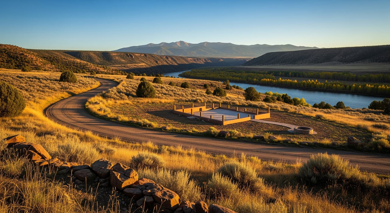
The Chama and greater northern Rio Arriba County area sits on the edge of the Southern Rockies, with valley ranchland, irrigated acequia properties, and forested mountain tracts near Carson National Forest. Many parcels are rural and recreation-focused, and seasons matter. Winter snow can limit road access, and summer brings wildfire considerations. Because of this mix, you should evaluate each property on five core themes: access, covenants, topography and buildability, water, and utilities, followed by a careful title review.
Start with deal-breakers first
Before you fall in love with views or tree cover, confirm the basics that can stop a purchase. Focus on legal and physical access, water options, septic feasibility, utility logistics, and title exceptions.
Access basics
- Legal access means you can reach the parcel by a public road, a recorded easement, or a prescriptive easement. Verify this in the title commitment and recorded plats.
- Physical access is the real-world condition of the road. In this region, roads can be steep, gated, seasonally closed, or unmaintained in winter. A parcel can have legal access but still be unreachable after snow.
- Road types differ. County roads may be maintained, while private roads rely on shared maintenance. Forest Service or BLM roads can have seasonal closures or restrictions.
- Easement details matter. Confirm width, surface responsibilities, maintenance obligations, allowance for utilities, and heavy equipment access for building.
Practical steps:
- Visit in different seasons or at least during spring melt and after storms.
- Ask the county road department about maintenance status and whether changes are planned.
- Obtain copies of recorded access or road maintenance agreements with your title report.
Covenants, zoning, and acequias
- Some subdivisions have recorded covenants that set rules for setbacks, building type, RV use, or short-term rentals. Request a complete copy and review dues, enforcement, and penalties.
- Rio Arriba County zoning and permitting control allowed uses and structures. Confirm whether your intended use is allowed and what permits you need for residential, agricultural, or accessory buildings.
- Parcels in irrigated valleys may be part of an acequia. Membership can include water use and shared maintenance obligations. Confirm the acequia lateral location, any water share, and assessments.
Practical steps:
- Ask for recorded CC&Rs and any HOA documents early.
- Call county planning to verify zoning and permit pathways for your plans.
- If acequia applies, obtain documentation of water rights and membership obligations.
Topography, soils, and buildability
- Slope affects driveway length, site prep, foundation type, drainage, and erosion control. Steeper parcels cost more to build on.
- Southern exposure can improve winter access and passive solar benefits.
- Septic feasibility depends on soils. A perc test or soil evaluation is typically required. Shallow bedrock, clay, or high groundwater can increase septic costs or require engineered systems.
- Check for flood risk near the Chama River and tributaries using FEMA flood maps. Floodplain designation affects building location and insurance.
- Wildfire hazard varies by vegetation type. Defensible space, mitigation, and insurance availability are important.
Practical steps:
- Sketch a preliminary site plan showing likely building envelope, driveway route, septic area, and potential well site.
- Arrange a soils and perc test during your option period.
- Obtain a professional review of slope and stormwater where needed.
Water: wells and surface water
- In New Mexico, wells require a permit from the State Engineer. Some basins have special restrictions. Historic well logs for nearby parcels can help estimate depth and yield.
- In valley locations, surface water through an acequia may be present. Water is governed by local acequia commissions and state law, and comes with obligations.
- Where wells are not feasible, some owners use rainwater harvesting, hauled water, or shared spring systems, subject to rules and health standards.
Practical steps:
- Search state well records for permits and logs in the area.
- Confirm whether any surface water rights are associated with the parcel and whether they are adjudicated.
- Speak with a licensed well driller or hydrologist about feasibility and timelines.
Utilities and communications
- Electricity may be nearby, or you may need a line extension. Off-grid parcels are common and may rely on solar with battery backup, generators, and propane.
- Internet varies. Fixed broadband can be limited in rural Rio Arriba County. Many owners use satellite options like Starlink or HughesNet. Cell coverage varies by carrier and micro-location.
Practical steps:
- Contact the local electric provider for a line extension quote and transformer availability.
- Test cell service on site and check carrier maps. Ask neighbors about real-world internet performance.
- Evaluate solar potential based on tree cover and orientation.
Title, minerals, and encumbrances
- A title commitment will reveal easements, liens, mortgages, and covenants. Order it early and review exceptions with your title company.
- Mineral rights are often severed. If minerals are not included in the sale, the mineral owner may have rights to explore or extract. Confirm what is included and consult a land attorney if needed.
- Check for back taxes, special assessments, or acequia assessments.
Practical steps:
- Ask your title company to explain any access or utility easements and encumbrances.
- Resolve problem exceptions before you close.
A practical due diligence timeline
Use this sequence to move efficiently from shortlist to closing. Adjust timing to match your contract’s option period and professional availability.
Pre-offer research
- Ask the seller or listing agent for the deed, plat, any recent survey, title commitment or exception list, utility distance estimates, CC&Rs, well logs if present, and tax history.
- Review county GIS for parcel boundaries and access context.
- Check FEMA flood maps for floodplain status.
- Search state well records for nearby well depths and yields.
- Study topographic maps and aerial imagery to understand slope, drainages, and potential building areas.
Offer and due diligence period
- Order a title commitment and review exceptions.
- Conduct a thorough site visit. If possible, visit in two conditions, such as dry and after moisture or snow.
- Commission a boundary or ALTA survey if access lines or acreage are unclear.
- Confirm legal access with recorded easements.
- Arrange soils and perc testing for septic feasibility.
- Consult a licensed well driller or hydrologist about well prospects and permits.
- Get quotes for electric line extension and confirm serviceability.
- Review covenants and any HOA documents. Confirm acequia obligations and any surface water rights.
- Check for environmental or cultural constraints if the parcel is near public lands or has prior uses.
- Verify zoning, building code requirements, septic permitting, and road status with county departments.
- Assess wildfire risk and talk with your insurance agent about coverage options.
Pre-closing
- Clear or insure over title exceptions. Obtain title insurance.
- Finalize any negotiated easements or road maintenance agreements in writing.
- Confirm closing documents include transfer of any agreed water shares, acequia rights, or mineral interests.
Post-closing
- Record road or maintenance agreements and any HOA documents.
- Set up utilities. Start planning driveway, site prep, septic installation, and well drilling within permit guidelines.
Compare parcels with this checklist
Use or print this list when you tour land near Chama.
- Legal and title
- Obtain title commitment and review all exceptions
- Confirm deeded access or recorded easements
- Confirm whether mineral rights are included
- Check for liens, back taxes, or assessments
- On-site and physical
- Visit parcel in both dry and wet or winter conditions
- Confirm physical access and road maintenance responsibility
- Identify likely building envelope and driveway route
- Note vegetation type and wildfire fuel load
- Water and septic
- Search state well records for wells and permits
- Arrange perc or soil test for septic feasibility
- If in an acequia system, obtain water-right documentation and confirm membership obligations
- Utilities and services
- Request electric line-extension quote and nearest pole distance
- Check phone, cell, and internet coverage on site
- Identify nearest emergency services, school district, and postal address
- Regulatory and constraints
- Check FEMA floodplain maps
- Confirm county zoning and building permit requirements
- Check for endangered species or cultural resource constraints
- Professionals to hire
- Title company for commitment and insurance
- Licensed surveyor for boundary or ALTA survey
- Land-use attorney for complex rights issues
- Well driller or hydrologist and septic installer for feasibility
- Forestry or wildfire consultant if parcel is forested
- Closing items
- Finalize recordable easements and maintenance agreements
- Confirm transfer of any water shares or acequia interests
- Secure property insurance and confirm wildfire or remote property requirements
Seasonal realities to plan for
- Winter access can be limited on rural or private roads. Ask about plowing and grading, and verify who pays for maintenance.
- Spring thaw can create muddy conditions that affect driveways and construction schedules. Plan site work around weather windows.
- Summer and fall may bring wildfire restrictions on public lands, and insurance can vary with vegetation and defensible space.
When parcels border public land
Many buyers seek parcels next to Carson National Forest or BLM lands. If the property relies on a federal road, confirm any seasonal closures or permit requirements. If you plan to build near the boundary, know exactly where private property ends to avoid encroachments. A survey can prevent issues with fences, driveways, or trails.
Internet, power, and off-grid options
If power is distant, a line extension may be expensive and take time. Off-grid setups are common in this region. Solar with batteries, plus a generator and propane, can work well if the site has sun exposure and good access for fuel delivery. For connectivity, many owners use satellite internet, and cell performance varies. Always test on site.
Budget planning and hidden costs
Beyond the purchase price, plan for driveway work, culverts, or permits for access, septic system design and installation, well drilling and equipment, line extension for power, and wildfire mitigation. If there is a shared road or acequia, expect ongoing maintenance or assessments. Getting quotes during due diligence will help you compare parcels on true total cost.
Ready to walk the land?
There is no substitute for boots on the ground. A guided site visit helps you evaluate access, cell coverage, slopes, likely building areas, and any red flags you can see in person. If you are weighing two or three parcels near Chama, schedule a focused tour and bring this checklist so you can make a confident choice.
If you are ready to explore, reach out to Antonio Martinez to schedule a free consultation and on-site assessment tailored to your goals.
FAQs
Can I build a home anywhere in Rio Arriba County?
- Allowed uses depend on county zoning, parcel size, and whether septic, water, and access are feasible. Confirm with County Planning and obtain required permits.
How do I know if I can drill a well near Chama?
- Check state well records for local permits and logs, then speak with a licensed driller about depth and yield expectations. A well permit is usually required before drilling.
What does buying without mineral rights mean for me?
- If mineral rights are severed, the mineral owner may retain exploration or extraction rights. Confirm reserved rights in the title documents and consult a land attorney if needed.
What hidden costs should I plan for when buying land?
- Common extras include road or easement maintenance, electric line-extension charges, well drilling, septic design and installation, driveway and site prep, culverts or driveway permits, and wildfire mitigation or insurance premiums.
How long should due diligence take on rural land?
- Many buyers use 30 to 60 days, depending on survey needs, environmental checks, and availability of drillers, inspectors, and county reviews.
Do I need flood insurance along the Chama River?
- If a lender finds the parcel within a FEMA-designated floodplain, flood insurance will be required. Even if not required, check FEMA maps early and plan building locations accordingly.